Meifeng Provincial Highway No. 14A
Location : Ren'ai Township, Nantou County
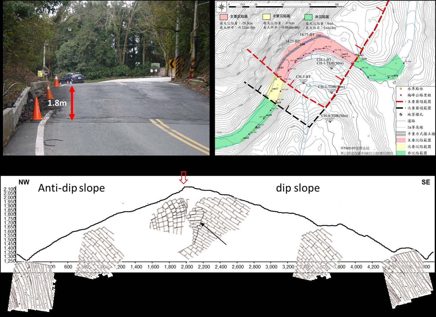
Site Characteristics Slope failure zone with persistent roadway settlement Horizontal displacement rate: 1.5 cm/month Vertical displacement rate: 1.8 cm/month
Project Scale Collapse mass exceeding 300,000 m³(approx. 120 m × 50 m × 50 m)
Geotechnical Features Block–Flexure Toppling Failure Mechanism. Findings from surface geological surveys, borehole investigations, ground displacement monitoring, and leveling measurements indicate that the deformation pattern does not match a typical translational landslide. Instead, the terrain is governed by flexural bending and toppling of rock masses, causing extensional subsidence. A linear scarp delineates the zone where the bedrock bends and topples toward the northwest, forming stacked rock blocks. High-angle tensile cracks commonly develop at the flexure zones, creating open pathways for water flow and allowing sandy materials to infiltrate. Thick accumulations of toppled rock blocks overlie the bedrock surface; post-rainfall runoff readily scours the matrix, resulting in localized sinkholes and tree tilting throughout the site.